A bingo card of what is out near your town this October, ranked by an open model on a laptop
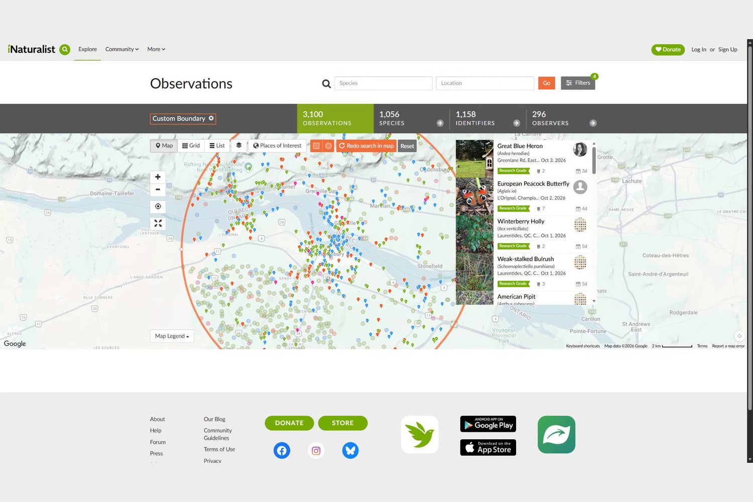
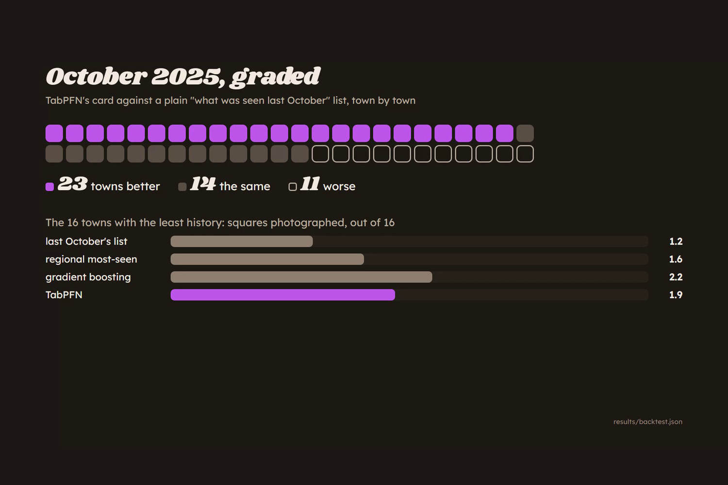
Around Hawkesbury, Ontario, iNaturalist holds about 3,000 research-grade records in total, and the most-logged species across every October on record has four sightings. Too few to rank a small town on its own. Nature Bingo borrows from 48 neighbouring towns: TabPFN, an open-weight model running on my laptop, learns ten years of Octobers and ranks the 16 things most likely out this October. In a blind test on October 2025 its card beat each town's last-October list in 23 towns, tied 14 and lost 11. Then I took Hawkesbury's card outside on my phone and walked it.

Too few sightings to rank a small town
The brief for this week asked for something that gets people off the screen, and said the best builds would make the screen the shortest part of the experience. A card you glance at, then put away until something turns up, keeps the screen short. The obvious way to fill it is to list what people logged near you last October, and in a city that works. In a small town it does not. Around Hawkesbury, iNaturalist holds about 3,000 research-grade records in total, and the most-logged species across every October on record has four sightings. Last October's list for a town that size is a handful of whatever one or two people happened to photograph, which is why I built this for small towns specifically.
Borrowing from the neighbours
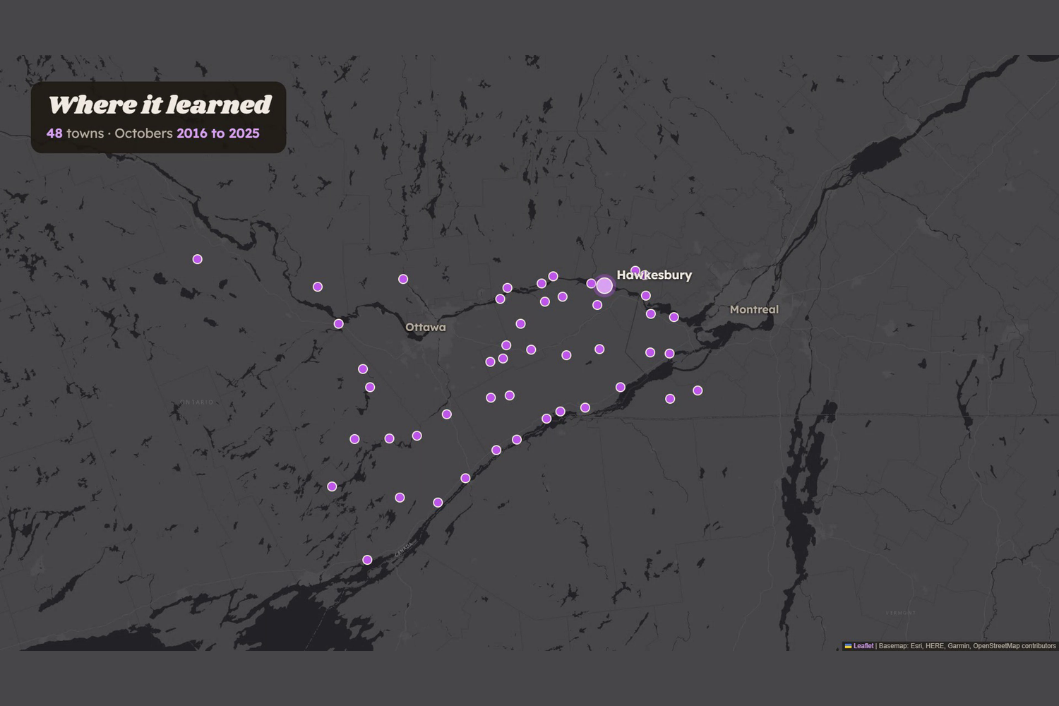
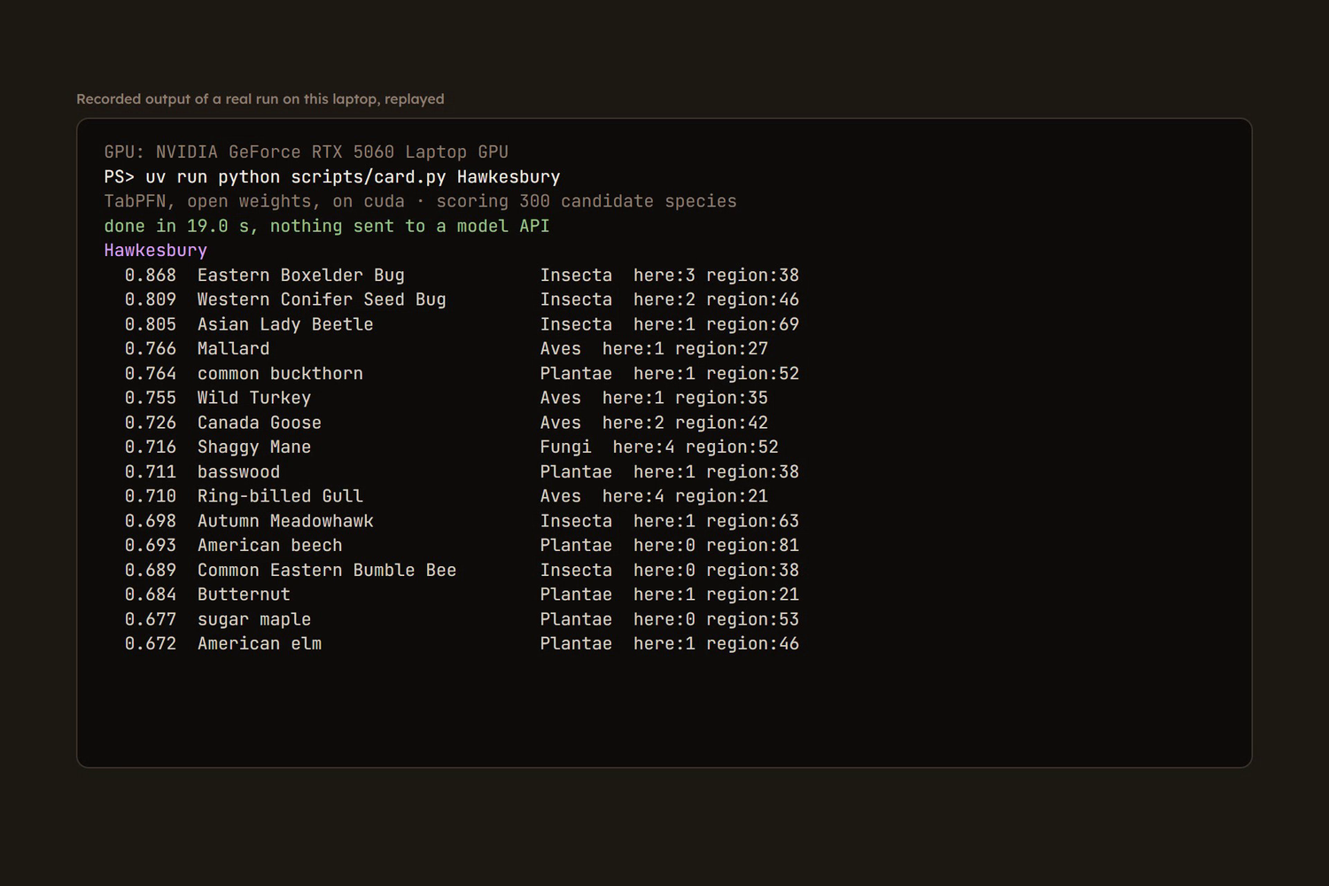
So the card borrows. TabPFN is an open-weight tabular foundation model, and it learns here from ten years of Octobers, 2016 to 2025, across 48 towns between Ottawa and Montreal. For each candidate species in each town it sees what was logged there before and what was logged across the region, and ranks what that town should expect this month. A town with almost no history leans on its neighbours; a well-logged town leans on itself. The model runs locally: Hawkesbury's card ranked on my laptop's GPU in 19 seconds, with nothing sent to a model API. That is the open-model part of the brief doing real work rather than decorating it, because a card for every small town is only free to make if the ranking is free to run.
Graded by what people went out and photographed
I did not grade it against my own idea of what should be out. I trained on the years before 2025, held out October 2025 entirely, made each town's card blind, and counted how many of its 16 squares somebody actually photographed and logged that month. Four methods, same towns, same month. TabPFN averaged 5.0 photographed squares of 16. Last October's list for the town averaged 4.4, gradient boosting 4.3, and the regional most-seen list 3.6. Town by town against last October's list, TabPFN's card was better in 23 towns, the same in 14 and worse in 11. Split by how much October history a town had, it led in the middle third (5.2 against 4.6) and the best-logged third (8.0 against 7.6).
The card says what it cannot know
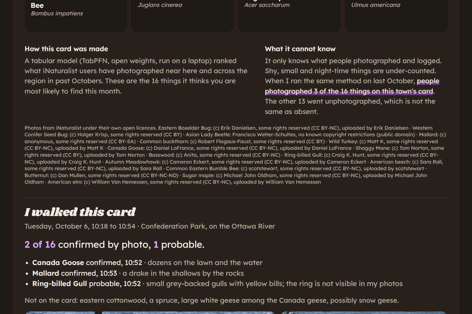
Every square is a guess about what people will photograph, which is not the same as what is there. Shy, small and night-time things are under-counted, and the card says so on its own page rather than in a README. It also states its own score for the town it is showing: when I ran the same method on last October, people photographed only 3 of the 16 things on Hawkesbury's card, and the other 13 went unphotographed, which is not the same as absent. Every photo on the card is an open-licence iNaturalist photo, credited by name under the grid.
I walked it
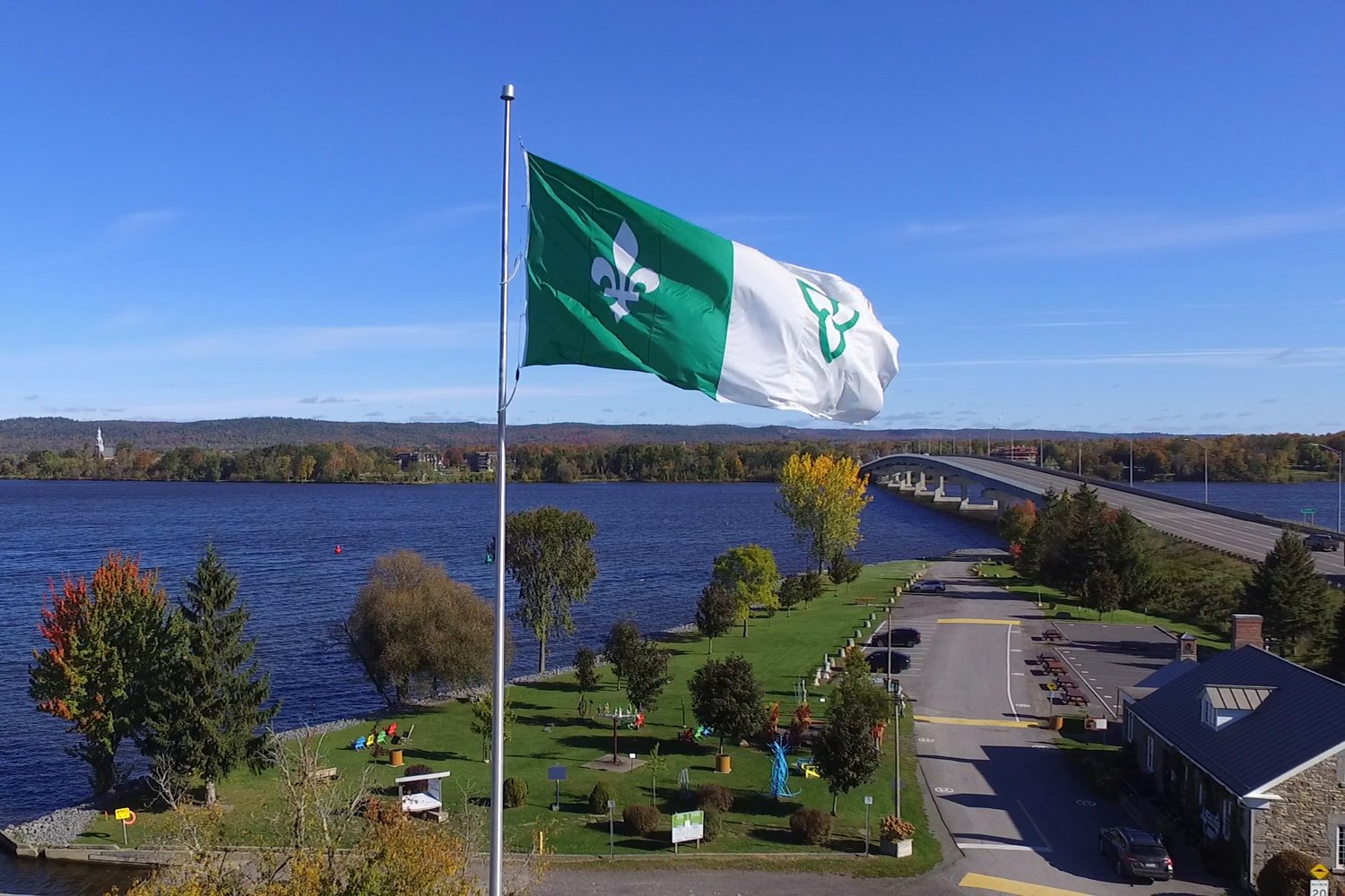
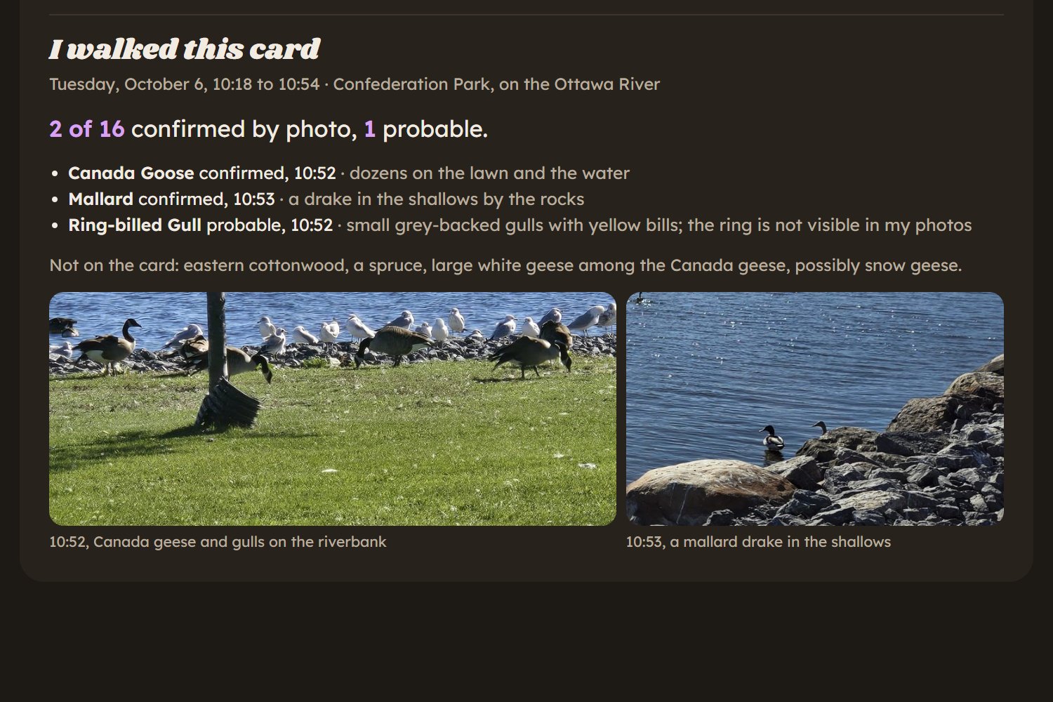
The brief asked entrants to take it outside and say how it went, so I took Hawkesbury's card out on my phone and walked it at Confederation Park on the Ottawa River on Tuesday 6 October 2026, from 10:18 to 10:54. My phone stayed in my pocket except to tap a square, take a photo, and fly the drone. In about half an hour I confirmed 2 of the 16 by photo: dozens of Canada geese on the lawn and the water at 10:52, and a mallard drake in the shallows by the rocks a minute later. Ring-billed gulls are marked probable rather than confirmed, because they were small grey-backed gulls with yellow bills and the ring itself is not visible in my photos. I also saw things that were not on the card: an eastern cottonwood, a spruce, and some large white geese among the Canada geese that may have been snow geese.
What is not claimed
The card is built for small towns, and in the 16 towns with the least October history TabPFN does not win: gradient boosting found 2.2 photographed squares on average and TabPFN 1.9, both better than last October's list at 1.2. Hawkesbury, the town I walked, is one of the places it lost, 6 against 3. On average across all 48 towns it is the best of the four methods, and that is the only claim the headline makes. The grader is also narrower than it looks: a photographed square is something a person logged on iNaturalist, so the test rewards guessing what people photograph, which tilts towards big, common, daytime things near paths. TabPFN was trained on 4,000 of the 85,974 rows available, because of how much it can take in one context, and the backtest took about eleven minutes against under a second for gradient boosting. And one walk of 36 minutes that confirmed 2 of 16 is a report of one morning, not a measure of the card.
Nature Bingo: a bingo card of the 16 things most likely out near your town this October, ranked by an open-weight model on a laptop
View the project